


Top 5 Walks near Granada
Andrew and I walk a lot. Well, we walk as much as we can, and realise that this is the only way to really get to know this beautiful country. So, we thought it was time to share a few of our favourite walks in our neck of the woods. This is by no means a definitive list, but it is not a bad Top 5.
Andalucia is vast. Its vastness is one of the geographical features that first drew us to this country, and I still remember the first time I drove inland from Gibraltar many years ago, and witnessed just how big the landscapes and the skies are.
When I was younger and less worldly, I fell into the trap of believing that Spain was a rather down-at-heels country dominated by the Costas where tourists swarmed and ate fish and chips and drank gallons of Watney's Red Barrel (this 'delicious' brew no longer exists, as far as I know). When I was asked to take a trip to Spain for work, I rather dreaded the visit, as I was better acquainted with the Greek islands and other countries within mainland Europe.
So, my low expectations all those years ago were completely reversed when we drove from the coast up into the mountains and to Gaucín, my first inland base. I fell in love with Andalucia almost immediately. Over an 18 year period, I came back again and again, and drove from the Costa de la Luz across to the Costa Blanca exploring many areas between. The hugeness of the landscapes, the immense variety, the colours, the light, the smells and the sounds become ingrained. The dazzling blue skies that go on forever, the changing cloud formations over the higher peaks, that feeling of escape whenever you scale a hill to take in the staggering views. That is what drew me here to live. When I brought Andrew back here (he had been before, but to the Costa!) I wanted to show him these elements that so grabbed me.

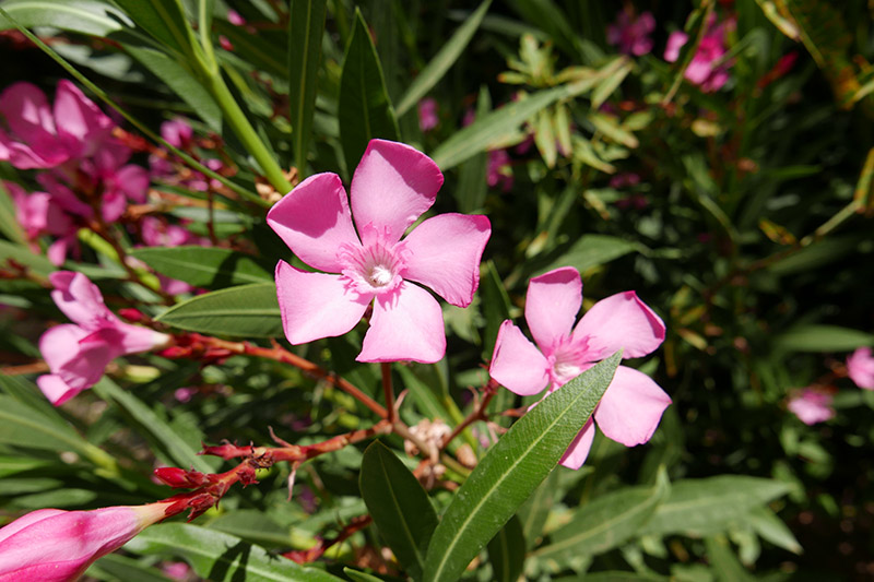
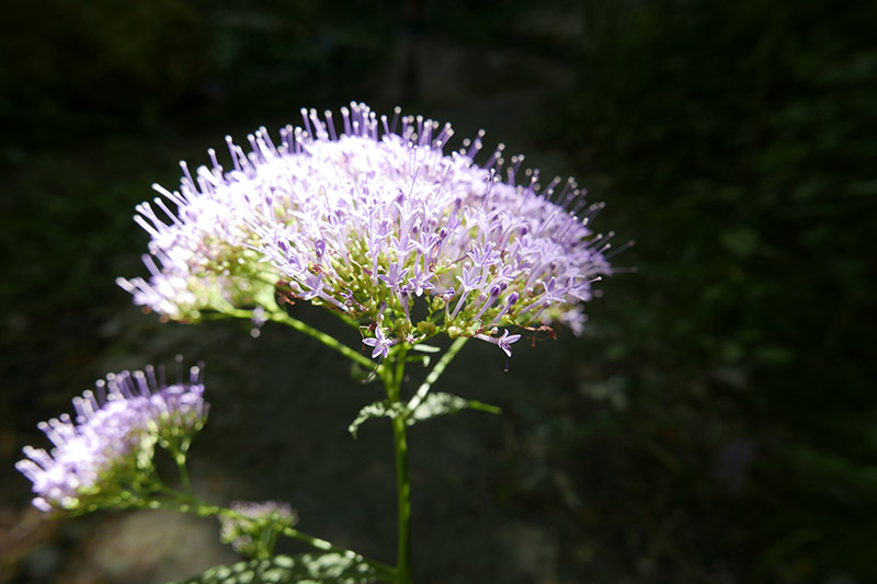
The landscapes of Spain play a huge part in our love affair with this country and we have only just scratched the surface. Even in our own corner of Andalucia, the landscape constantly throws up dramatic surprises: light cast on a mountain changes its character in a second; lenticular clouds forming over the Sierra Nevada cast a surreal spell; wood smoke, reluctant to leave the low olive tree canopy, seems representative of the gentle way of life here. The relationship with nature here cannot be half-hearted. You are invited to immerse yourself in it; looking at the landscape from a distance belies the real treasures.
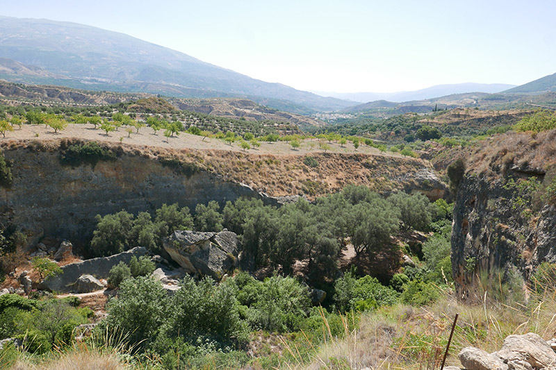
Sierra Nevada - Quéntar Loop.
Length: 14.5km
Time: 4 hrs
Max altitude: 1279m
Difficulty rating: Medium
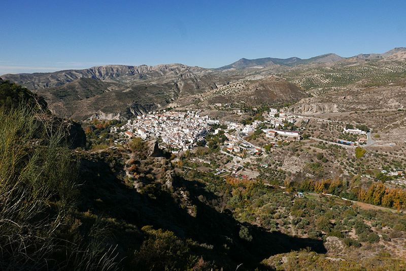
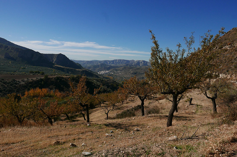
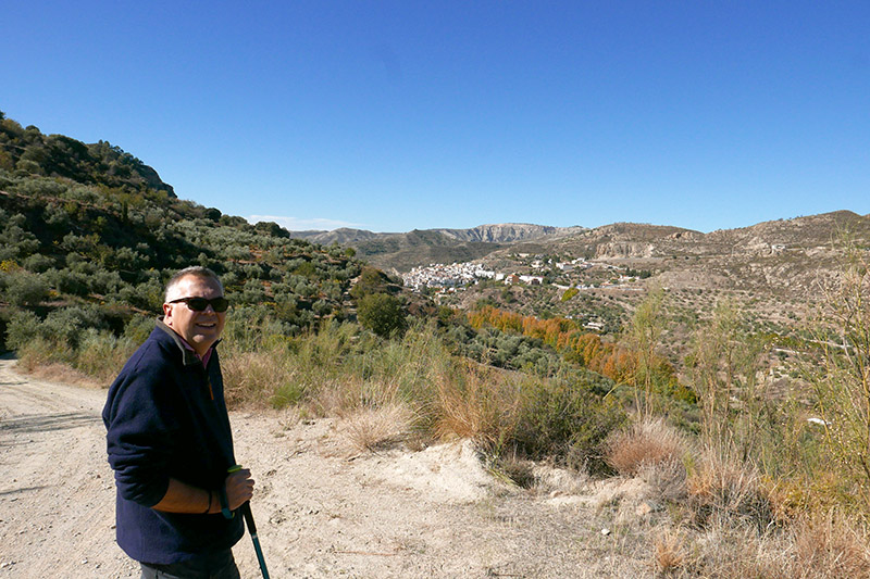
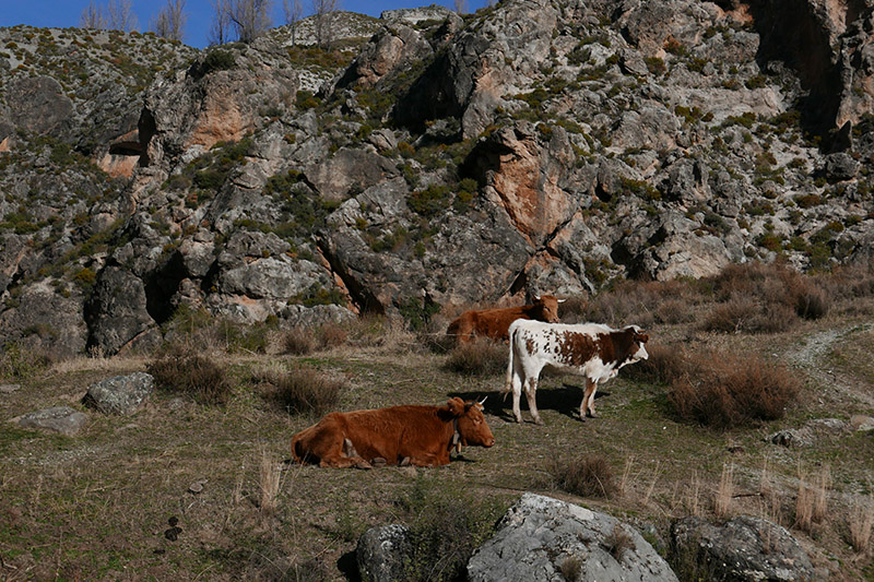
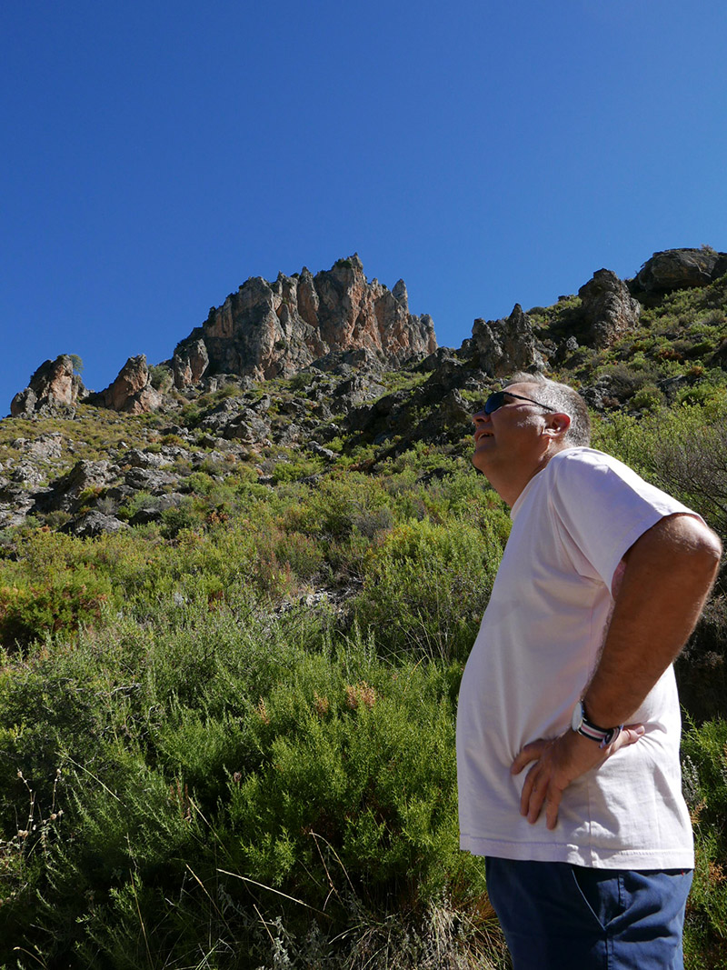
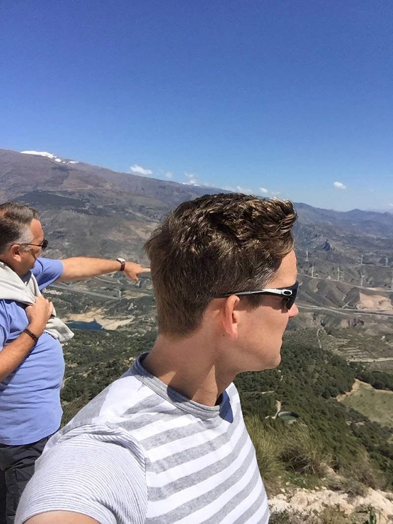
This was our most recent weekend walk, taken on a beautiful November day when the visibility was crystal clear, the sky an unbroken blue and the sun still contained enough heat to warm hands and face. We haven’t really explored much of the wide valley that lies to the north of the Sierra Nevada and just to the East of Granada. We ventured out this way once before, and have skirted the valley on a number of occasions as we took the main route up to the Pradollano ski resort, but we haven’t dug deep.
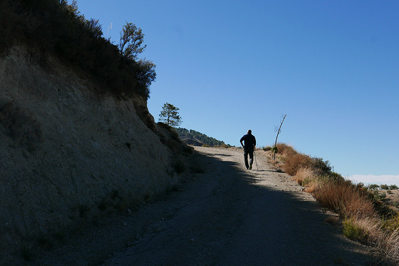
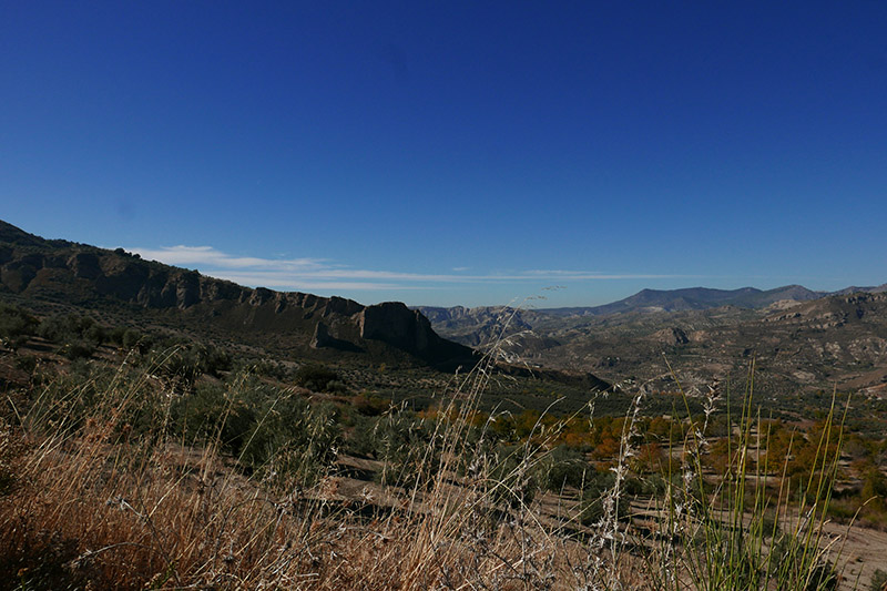
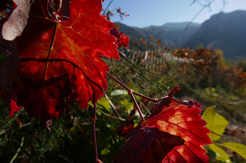
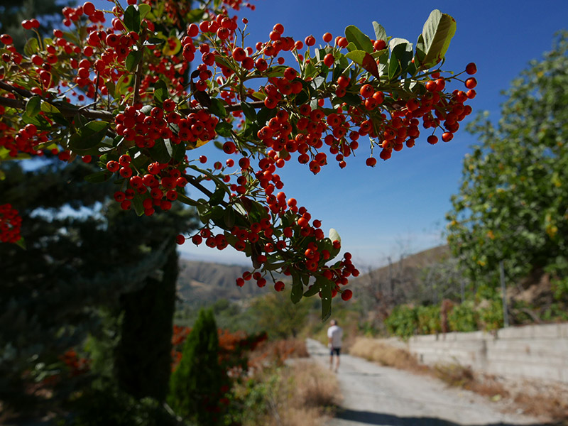
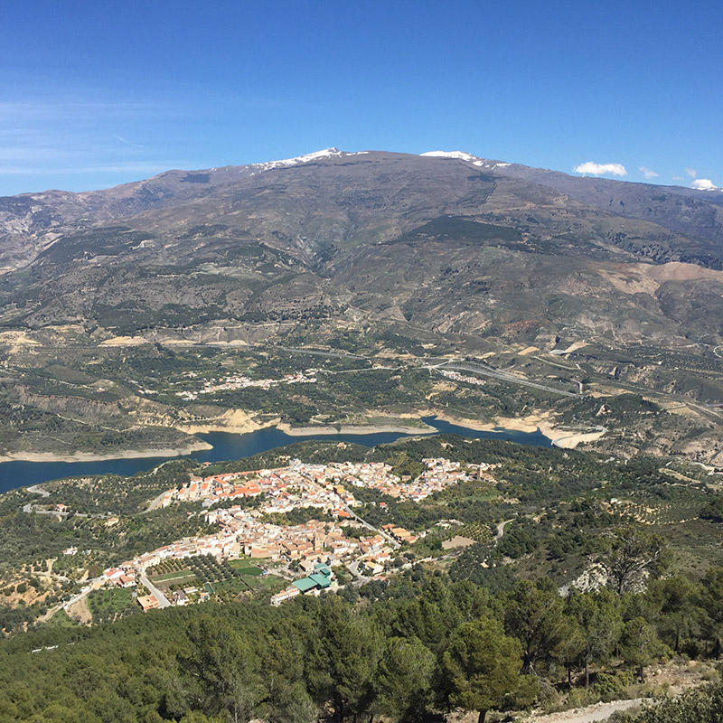
Quéntar is a rather pretty hillside village about 20 minutes’ drive from Granada, and the countryside here is not too dissimilar to parts of the Alpujarras to the south of the Sierra Nevada. Driving along the valley bed in Autumn is a delight, as the trees are still clinging on to their brightly coloured leaves, all of which were burnished by the bright sun. The directions to the start of this circular walk take you down a single track about 1 km on the other side of the village, and the directions warn you that the initial part of the walk is mainly uphill. The length of the walk is 14.5 kms, and for the first 5 or 6 kms, you do face a fairly steady climb from 861 metres altitude to 1,279 metres. This, however, is one of the unmitigated joys of walking in this part of Andalucia. With almost every step, the view widens and layers of the landscape backdrop part to reveal distant vistas, changing mountainous forms, deep gullies and savagely outlined escarpments and outcrops. The light in Autumn is spectacular, and the vague scent of woodsmoke lingers in the air. In the distance, you can just make out the muted sounds of workers harvesting olives and tidying up groves, but these spectral sounds wax and wane and for most of the walk you hear nothing.
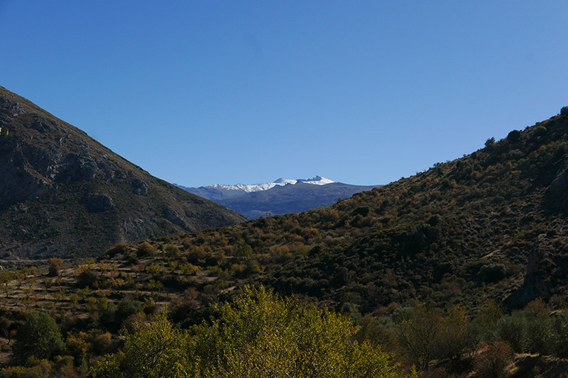
As you reach the highest point of this walk, the near landscape takes a step back to reveal the beauty of Pico del Veleta, the second highest peak in the Sierra Nevada, its jagged outline crusted in the season’s first fall of snow.
The rest of the walk is downhill, and the early part of this descent cuts through meadows and groves that seem at odds here, reminiscent as they are with areas of the gentle landscapes of the Home Counties of the UK. That said, look up from the pasture and there can be no mistaking that the vast and breathtaking mountainous surrounds are Andalucian through and through.
This is a beautiful walk through an ever-changing landscape, long enough to give you a challenge but with terrain that is not too difficult to navigate.
Sierra de Huetor - Cueva del Agua
Length: 8km
Time: 2hrs
Min/Max altitude: 1298m /1565 m
Difficulty rating: Easy
This is the first and only walk we have done in the gorgeous Sierra de Huetor range, but there are many more to be enjoyed here and we will be ticking them off, one by one! The Sierra de Huetor is the mountain range that runs to the north of the Sierra Nevada, and if you ever want a stunning view of the length of the snow-capped Sierra Nevada, then this is the place to come to get that view.
We were initially drawn to this range for a couple of reasons. The first is that it catches your eye as you drive from Guadix to Granada if you are heading away from Almeria. As you near Granada, the mountains close in around you, with slopes dense with pine trees. On a typical hot summer’s day, this is a place to seek some sanctuary in the shade, and it is clear that a great many Granadinos do scuttle here for days out when the city temperatures become a little too much to bear. Because the slopes along this valley face south, they seem gentler and more welcoming than the dark, north-facing and more ominous slopes of the Sierra Nevada.
The second draw for us was that the south-western edge of the Sierra de Huetor shelters the villages of Alfacar and Viznar. Alfacar has the dubious claim to fame of being the village closest to the spot where Federico Garcia Lorca was taken and murdered by Nationalist troops in 1936. The peaceful nature of both Alfacar and Viznar now, as with many sierra villages in Andalucia, belies their turbulent histories during and after the Spanish Civil War. However, the history, both recent and ancient, fascinates us both.
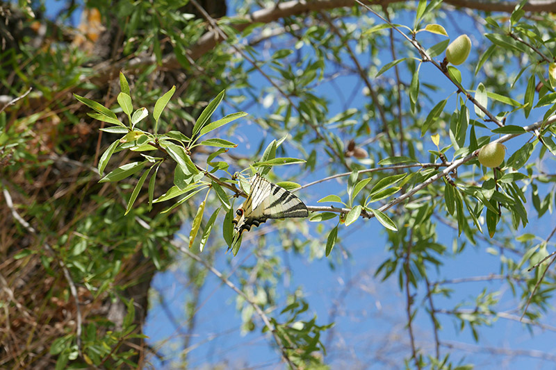
To get to the Cueva del Agua walk, you drive up beyond Alfacar and into the National Park. The scenery, as you gain altitude, is truly breathtaking. Andrew and I brought Andrew’s father John up here last May, and as a historian and nature-lover John was in his element. Leave Granada below, and enter an untouched world of magical rock formations, ancient trees and flora and fauna around every corner. We have seen deer, orchids, brightly coloured butterflies and much more during our too infrequent visits to this range.
The walks, and ‘recreation’ areas, are clearly signposted, and there are forests stretching along the ridges of the range. It is glorious up here!
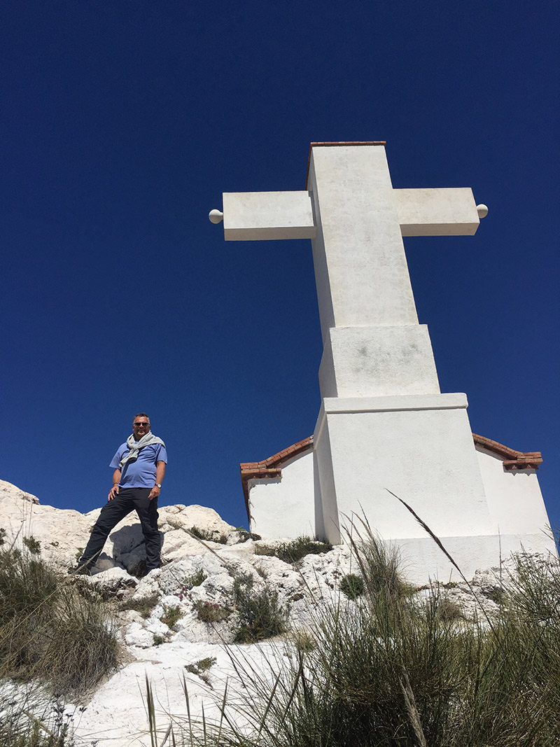
From a car park near a very welcoming bar/restaurant beside the Alfaguara picnic area, a good track winds up through pine trees and you almost immediately get lost in this magical, sun-dappled and sweet-smelling world. The circular route is around 8kms long and is not massively taxing, but what you might miss out on in terms of athletic challenge is more than compensated for by the views around every turn. En route, you will pass the natural cave after which the walk takes its name - the Cueva del Agua - and it is from here that you will get some the best views of the Sierra Nevada that you are likely to witness.
The halfway stage is below the Cruz de Viznar, where there is a wide sunny plateau that invites you to sit and munch on whatever comestibles you might have brought as sustenance. We find that Oreos, cake of some variety and chocolate go a long way.
On our first visit here with John (Andrew’s father), we only went on a short exploratory stroll whilst leaving John on the terrace of the bar where he was treated to generous helpings of Ensaladilla Rusa to accompany more than one recuperative lunchtime vino…
Valle de Lecrin - Barranco de la Luna
Length: 4km
Time: 2hrs 30mins
Max altitude: 600m
Difficulty rating: Medium
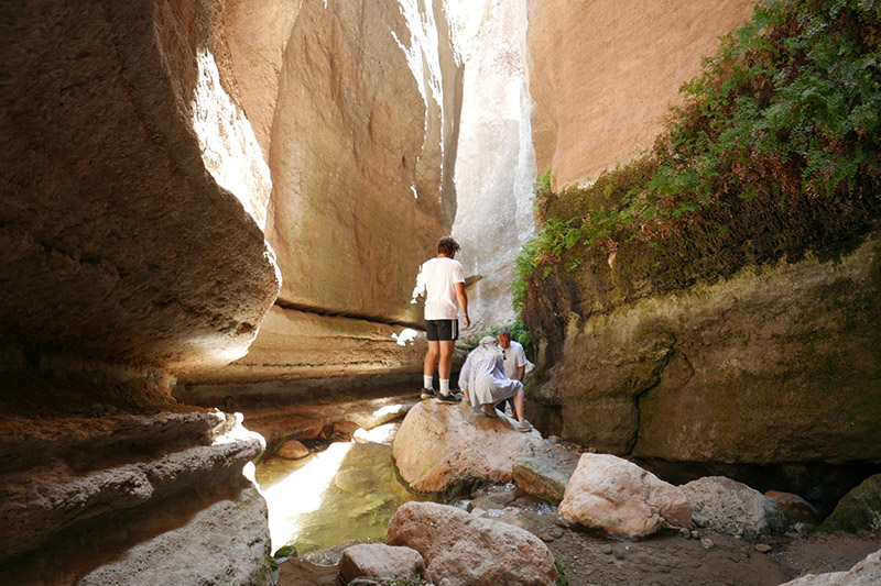
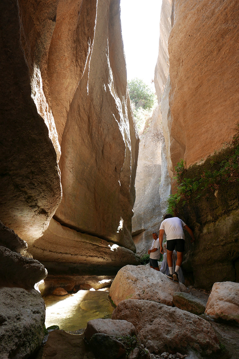
A well-kept secret! This is not really a hike, bur rather a trip back into some Jurassic wonder world that is all but hidden from any view. The surprising this for us is that it happens to lie on the other side of the hill that rises just behind Saleres, our own little village.
In all the years that I have known this village, I never knew that there was such a spectacular walk on the doorstep. When Andrew and I moved here, we started to notice the odd reference to this walk nearby, but knew very little more. Gradually, details trickled in - photographs of incredible cliffs, a gorge, a deep-cut river course, but absolutely no indication given as to its whereabouts. Eventually, we delved a little further and found the Barranco mentioned on the Wikiloc website, a geolocation guide with many listed walks. We managed to find where the walk supposedly started, so decided to venture out. Sure enough, literally above the village, there is a path that leads down through olive and orange groves to the alleged location of this mysterious walk.
We got lost on more than one occasion - paths, or what seem to be paths, lead into the groves and then simply stop. We retraced our steps numerous times, brushing past obstinate branches determined not to be outdone. It did seem that the local farmer had become fed up with other walkers who had clearly tried to find this secret walk, as hurdles and dams blocked routes making it very difficult to get anywhere (clearly the farmer’s aim!).
Finally, we got to the bottom of a valley in what we assumed was the right area, and there was a pitiful trickle of water spitting its way through undergrowth. Not much sign of a barranco. We hopped across the dribble, and clambered up the other wide of the valley until we reached open fields. Well, we had evidently not found the barranco, and we were now stuck in olive groves, in the sun, not quite knowing where to go, except onwards.
Suddenly, to our left, we became aware that there was, indeed, a massive rift in the landscape and there it was - this incredible gorge. We were above it, whereas the information we had stated that it was possible to walk right through it, along the river bed. Was there a way down from where we were? No. So, we ended up walking miles through fields to the far end of this gorge and then walking down into it from that end. By this stage, we were exhausted, and the early November sun had been pretty warm, but we had found the location of the gorge, and we had found another way in.
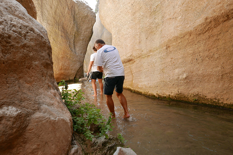
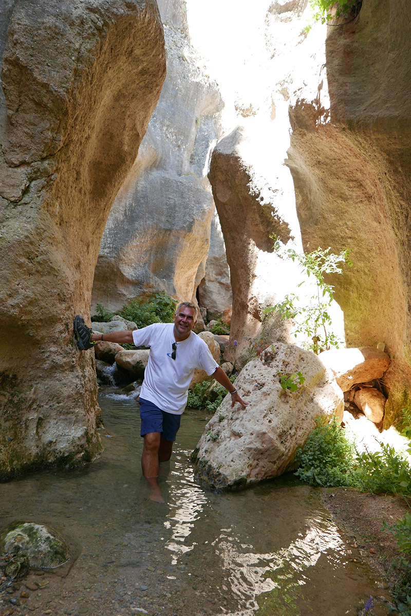
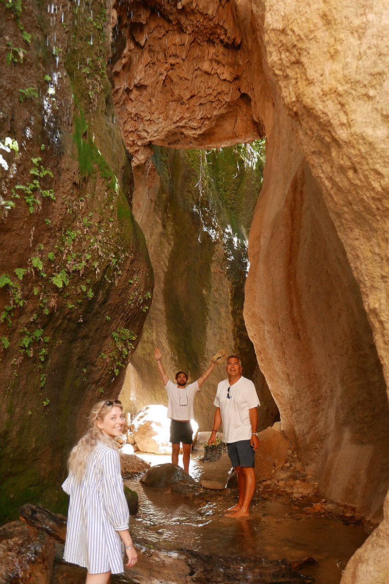
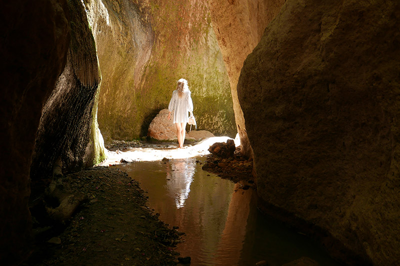
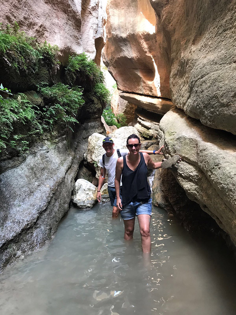
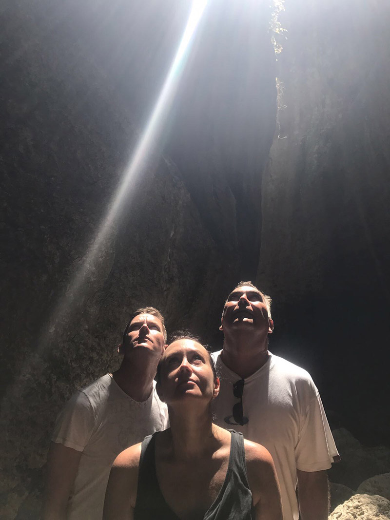
We have subsequently been through the gorge several times, with family and friends, and it never fails to thrill. If you walk up the road from Saleres to Albuñuelas, past the little cemetery, you come across a concrete road on the right that drops down to the head of the gorge. The early part of the walk leads through the shallow wooded bed of the river, and the sun filters through branches and warms the air. Gradually, the gentle path meanders up into few rocks, which become boulders and then formations as the landscape takes on a completely new character. Olive trees resist the change of the surroundings, and little steps have been carved into terraces to provide traction for the donkeys from years gone by as they hauled the harvest out of the gorge. The sun beats a retreat as you become aware that the world has risen up overhead and you are deep in the bowels of the Andalucian landscape. Finally, the olive trees surrender to ferns and mosses, as water drips incessantly from crevices up above. The glow from the sun, however, still manages to cast a rich light on the ochre cliff faces which, in turn, illuminate the darker corners with an eerily beautiful golden glow.
Walking down the river bed is wet. There is no path, so waterproof shoes or bare feet become essential. The sharp little stones take their toll on bare soles, so some form of waterproof shoe makes sense. This is such an adventure, clambering over high boulders, and taking something of a leap of faith into thigh-high pools and hoping that you will touch the bottom. This is a pre-historic place,and you feel disconnected with the real world you left behind. It is, at once, magical, mysterious, beautiful, elemental and exciting.
Follow the trickling stream as it totters over its sharp little bed and the high cliff sides gradually give way once more to undergrowth and the ubiquitous olive tree. The sun creeps back in, and the air warms up again. Suddenly, the banks drop down enough to provide a route out at the very spot where Andrew and I, on our first exploration, crossed the trickle little knowing what lay beyond. Climb up the terraces of olive trees and look back to where you just emerged, and all signs of the gorge have disappeared. All you can see are hills, trees, blue sky and the jagged horizon.


AW writes...
Monachil - Cahorros gorge
Length: 7.8km
Time: 2hrs 30mins
Max altitude: 1123m
Difficulty rating: Medium (or easy if you are a child)
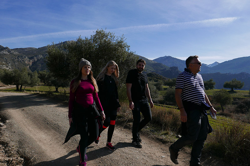
This walk was one of the first that we completed after we moved here last year. We thought either we had just made a lucky choice or maybe all walks were this breathtaking...
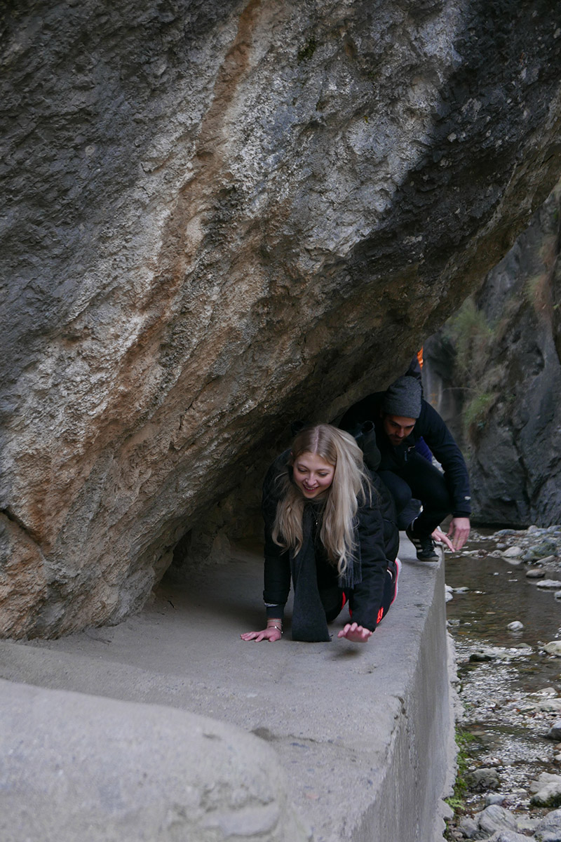
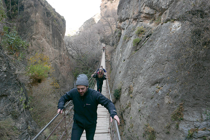
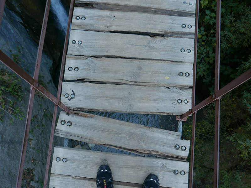
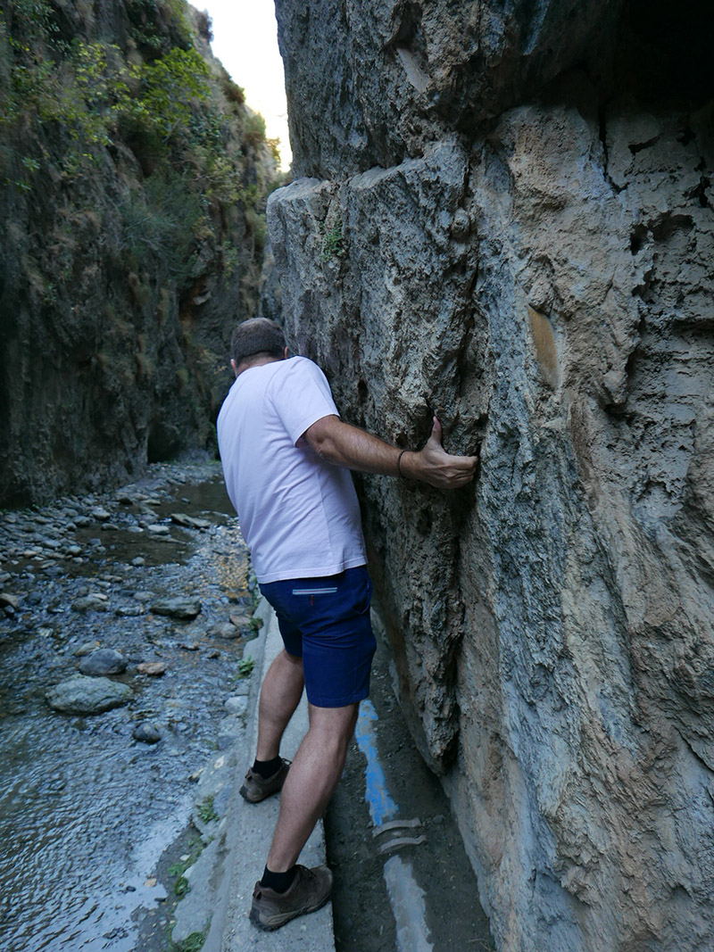
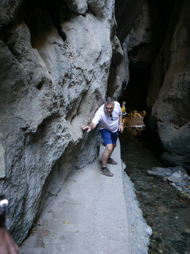
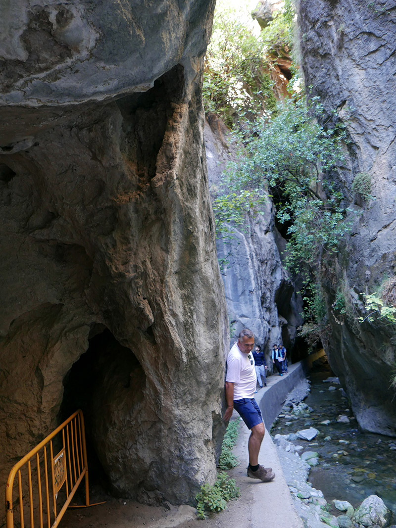
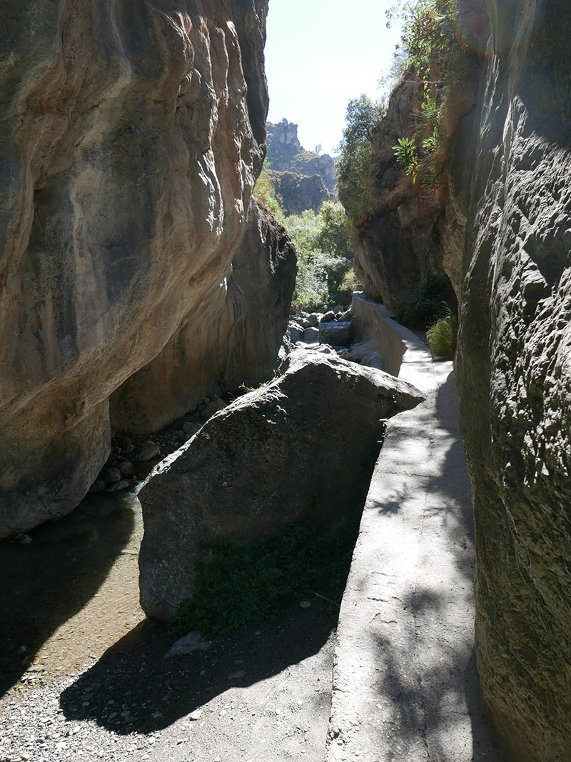
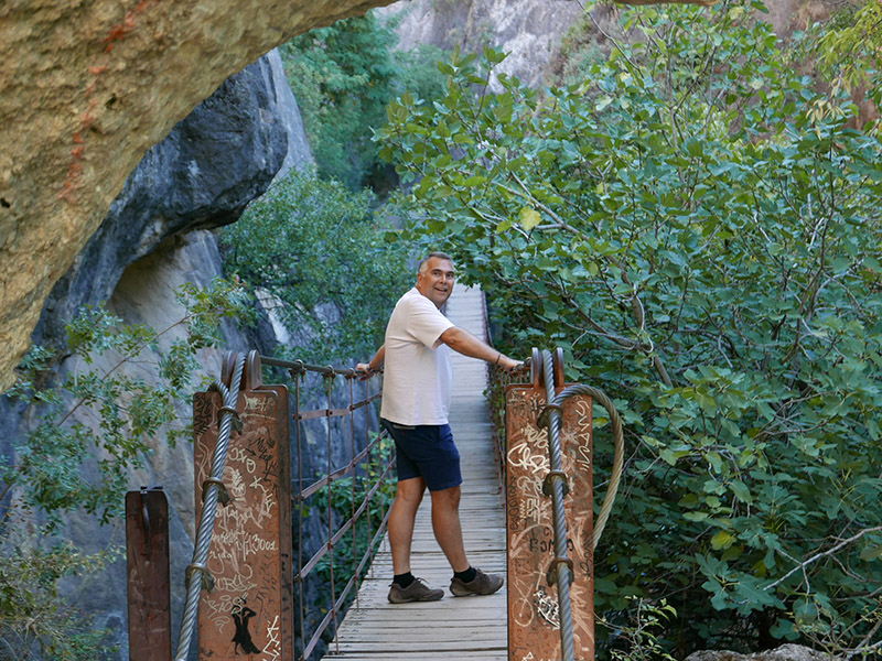
Monachil is about 15 mins from Granada and it's the gateway to the Sierra Nevada ski station, it's a popular walk with Granadinos so don't expect to be alone especially if you go a the weekend. It starts just above the town by the restaurant El Puntarron. The gentle path leads you along irrigation water channels called acequias. Before long the path dips down into the gorge and this is where things get interesting. You reach your first suspension bridge and its pretty impressive. I don't have a problem with heights but even so it was a fairly exhilarating crossing. What wasn't exhilarating were the children jumping up and down making this a potentially life threatening situation. We managed to overtake the kids so we had the next suspension bridge to ourselves and confidently crossed it.
Then we get into the gorge proper, and when I say IN the gorge I mean literally clinging onto the walls of this impressive and slightly challenging part. It turns out that this section is not challenging for children under the age of 10 as that group of kids caught up with us and whilst I was crawling (Ian was bum shuffling) they were merrily trying to overtake us on this very narrow strip of concrete (see pics). On we pressed thinking it would be easier round the next corner but it stretches for a good kilometre, often having to retrace our steps as someone was walking the other way...with two dogs (we don't recommend taking dogs on this one by the way) Once we conquered this, we 'hopped' over a small river and suddenly found ourselves in a meadow with vast cliffs rising up ahead of us. On we pressed.
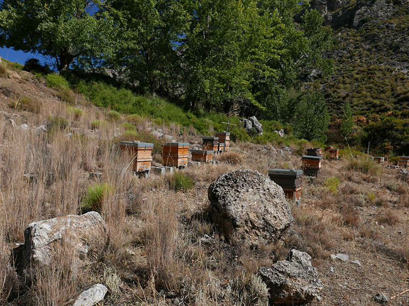
The next section of the walk is fairly steep up a windy rocky farm track past a lovely apiary of bee hives, Just when we thought actually we've had enough of going uphill, we reached the summit and took in the far reaching views to Granada and beyond. Luckily from this point its downhill all the way winding firstly though almond groves (In Feb/March these will be pink with blossom). Then lower down are olive trees until we finally saw the restaurant where we started from. We can highly recommend this restaurant, they have a lovely terraza at the back and in winter they have a log burning fire. The food is great and the beer cold, perfect restorative fodder after a good 2 to 3 hour walk.
Ermita del Santo Cristo del Zapato
Length: 7.8km
Time: 2hrs
Max altitude: 1100m
Difficulty rating: Medium
We have done this walk many times and if you come and stay with us you may well have been dragged up here! I say dragged, well, not dragged but this is fairly steep up and down route but worth every step as the panoramic view from the top is awesome (I dont like that word but here, it works).
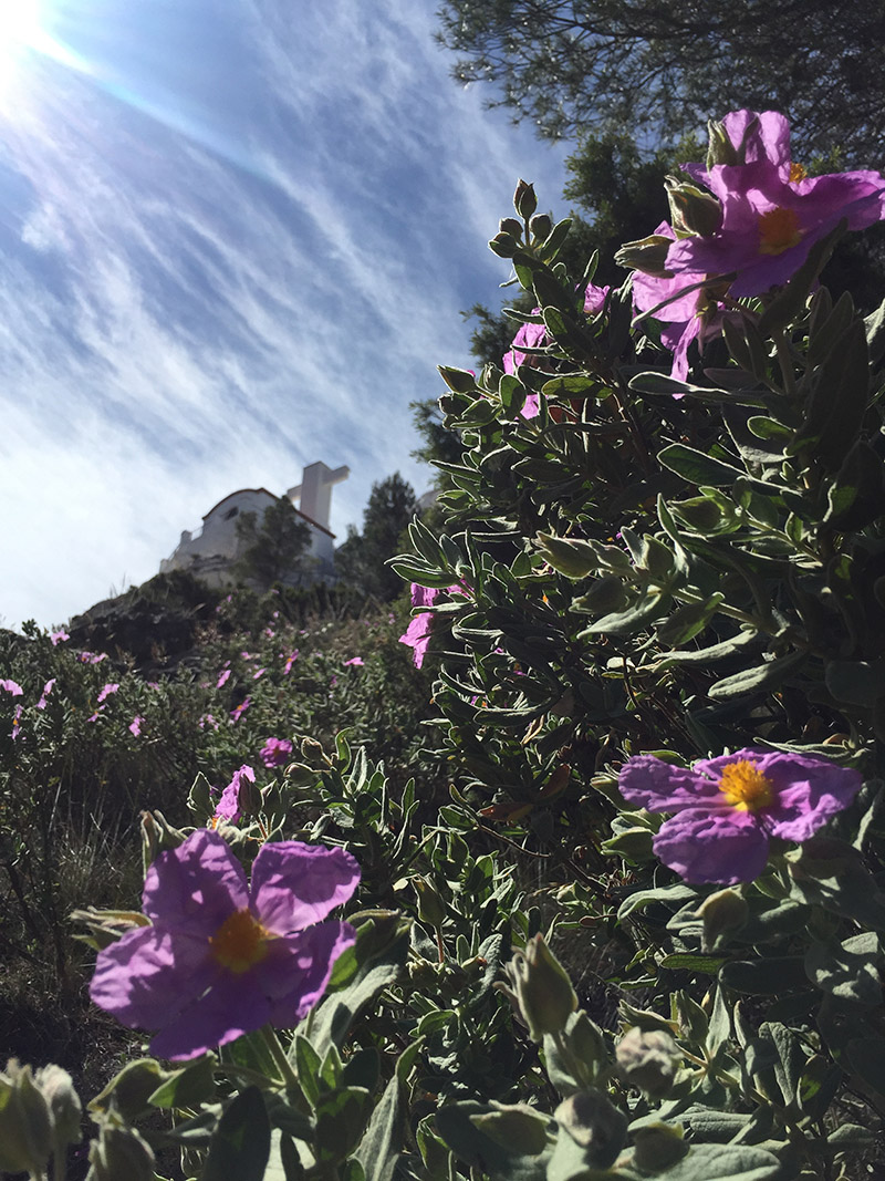
It starts from the village of Pinos Del Valle, in the Lecrin valley not far from our house. The path is very clear from the start, right off the road by the lavadero (or old laundry) and then left by the water fountain (fill water bottles here). The path weaves its way up through the pine trees all the way to the very top. Almost every single time we have done this walk we think...I'm sure it wasn't as long or as steep as this last time! But eventually you can catch a glimpse of the destination. Painted white, is the Ermita del Santo Cristo del Zapato, this translates to 'The hermitage of Christ of the shoe' Well, this is exactly what it is and when we finally reached the top, caught our breath, struggled up the last few absurdly enormous steps to the door of the Hermitage , we undid the frayed piece of rope holding the door closed and sure enough there, in the middle of the altar is a shoe - well, ok not actually a shoe it's a beautifully embroidered brown brogue shoe, we didn't realise that Jesus had such a good cobbler. However there it is. We believe that the painting next to the altar is also of great significance, I can't quite get to the bottom of why, and by this point we really needed to sit down, eat a bar of chocolate and OH MY GOD THE VIEW! Yep, these pics just don't quite do it justice. You need to experience the vastness and distance and general on-top-of-the-world feeling. My lungs have never breathed so clearly and deeply and happily as standing on the top of that hill. Every ounce of stress gets whipped away.
We just skip down the hill after that blast of elation. Actually we don't quite turn into mountain goats as its slippy and steep so TAKE CARE! But we do feel good after this one. And even better when we have an ice cold beer on the terrace at the nearby Bar Venecia who keep their 'tubo's' (tall beer glasses with handles) in the freezer. Bliss!

We would not have found many of these walks without the help of a great website called Trek Sierra Nevada www.treksierranevada.com. They provide comprehensive route directions in a downloadable PDF, points of interest and clear maps.
If you would like more information about any of these walks do get in touch or maybe you could recommend some walks for us to try. What's you favourite in this area? Let us know!


